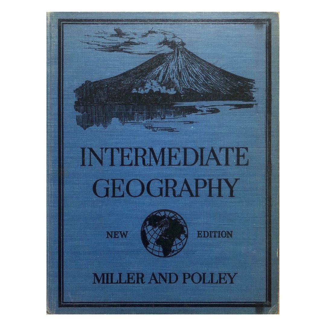
Intermediate Geography by Miller and Polley
Intermediate Geography by Miller and Polley
SKU:PB-10-30097
Couldn't load pickup availability
Low stock: 1 left
From Ancient maps and the rise of a nation by Ambeth R. Ocampo, Philippine Daily Inquirer, May 30, 2018:
“Intermediate Geography” by Miller and Polley was the last textbook used in Philippine schools in the 1950s that probably became extinct when people realized that except for Mayon volcano on the cover, the content was exactly the same as the 1918 edition! Antique maps of the Philippines are valuable as singles but, when seen in a series, depict in their detailed differences the emergence of a nation. Historical rights are irrelevant following agreements in the United Nations Convention on the Law of the Sea, but the Philippines has proven that China cannot produce a map older than the 1734 Velarde map showing Panacot (Scarborough Shoal) and Los Bajos de Paragua (Spratlys) in their territory. It is significant that the three shoals indicated in the map bear the names: Galit (Anger), Panacot (Threat) and Lumbay (Sorrow), ancient names that can be emoticons that express how Filipinos feel about our territorial dispute with China. Maps teach us more than geography, they teach us nationhood and identity.
- Free shipping on US orders over $150 (NJ stock only)
- Ships from New Jersey or Manila, whichever location has stock is and is closer. See options at checkout.
Author: Miller and Polley
Publisher:
Year: 1951
Condition: Good
Cover: Hardcover
Language: English
ISBN:
Return Policy: Let us know within 14 days of receiving your order to receive store credit.
Shipping: We ship globally. Message us if you do not see your country at checkout. See FAQs below for more info.
Share

FAQs
Where do you ship from?
We ship from two locations, Manila and New Jersey. Your books are always sent from wherever they are currently in stock. If an order includes books from both locations, we usually combine everything into one shipment to reduce packing waste. If you would prefer items to be sent separately, just let us know. We are happy to accommodate.
You can read our shipping policy here.
What are your shipping options?
For books shipping from New Jersey, we offer USPS Media Mail, USPS Ground Advantage, and USPS Priority Mail. For non US addresses, we ship via DHL.
For books shipping from Manila to the US, you can choose between two options.
Express: Your book ships directly to you via DHL. This is the fastest option.
No Rush: Your book is included in our regular shipment from Manila to NJ. Once it arrives in NJ, we ship it to you right away via USPS. This option takes longer but helps keep shipping costs lower.
For non US addresses, we ship via the Express option.
You can read our shipping policy here.
How can I reduce my shipping fee?
One important thing to know is that we do not make any profit on shipping. We simply charge what our couriers charge us. Because we ship in bulk, we often receive discounted rates, and we pass those savings directly on to you. Our goal is always to get your books to you as affordably and responsibly as possible.
If you are ever unsure which option to choose, or if timing matters for a specific order, please reach out. We're happy to help.
What is your return policy?
If you are not satisfied with your purchase, we will be pleased to issue store credit within 14 days of order fulfillment.
- Sale items and gift cards are final sale.
- We do not give refunds except in cases where we have made an error. If we made a mistake, we will rectify the error and refund reasonable return shipping expenses you incur.
- If you wish to cancel your online order for any reason, you will receive store credit, not a refund.
You can read our full return policy here.
Can you help me find books not offered in your shop?
We offer a free book search service. Give us the details of the book (title, author, publisher, year) and we will look for it for you. If we find it, we will give you a quote so you can decide whether to move forward or not. There is no obligation to make the purchase.
Do you ship to my country?
Yes, we ship globally. If you do not see your country as an option at checkout, please let us know so we can make the necessary arrangements.
I'm happy with the book. Very good condition. Just imagine this book, by 2032 would be 💯 100 years old !!.
I had this book back then when I was about 5 year s old. I remember it was the 1951 edition. It got lost. I suspected my nephew sold it. Didn't care too much about, since I must confess; I did not understand the book anyway.
But I love Geography anyway. Maybe by now, I will 😆😁

